
Global climate change and nature crises, exacerbated by anthropogenic activities, are ever-pressing issues. Human population crossed 8 billion on 15 November 2022, an estimated 4-fold increase since 1922. Extreme weather events, wildfires, heat waves, typhoons, droughts, and flooding are increasing, and global sea level rise in 2021 was a new record high. Average species population abundances have declined by 44% since 1970. These crises are causing more food and water shortages, pandemics, and increased conflict.
However, well chosen actions aimed at achieving net zero greenhouse gas emissions and reducing biodiversity loss could lessen the negative effects. Here we describe the Scottish Government RESAS funded, Biodiversity and Ecosystem Tools project led by Biomathematics & Statistics Scotland to help scientists, policy and decision makers develop, select, and carry out such action. This research extends and develops broad use statistical and mathematical tools for modelling natural populations and community dynamics and biodiversity and environmental systems. Consistent with the Scottish Government's commitment to Open Science we place openness, transparency and research integrity at the heart of our work.
Statistical Tools for Biodiversity and Environment
1. Modern approaches to time series data analysis: nonlinear Hidden Markov models and change points
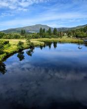
- Long-term ecological and hydrological monitoring programs are increasing and providing more and longer time series.
- Markov switching models are powerful tools that use these data to characterise nonlinear relationships, non-homogeneous, time-varying, and latent (hidden) Markovian processes.
- Such models can be used to uncover and quantify the mechanisms underlying climate and nature crises and predict effects of management actions.
2. Statistical methods for biodiversity modelling
Joint Species Distribution Models (JSDMs) can quantify and explain biodiversity loss. They are fit using data from Large-scale biodiversity monitoring programs. Effective use of such data, with thousands of species and hundreds of environmental variables, is a significant challenge.
Simulation studies are being used to explore the strengths and weaknesses of current JSDM implementations, and develop strategies for dealing with biases in the data, including the use of expert knowledge to constrain and inform the model, and model scalability.
Modelling Natural Population & Community Dynamics
1. Mathematical models for natural pest management
- Animal pests cause up to 15% crop yield losses globally (40% in unprotected crops), worsening food shortages.
- Control by natural enemies is an alternative as pesticides become unavailable.
- Spatial, multi-species, stage-structured models of host-consumer interactions are being used to investigate effects of changing landscape and climate.
- This allows identification of potential control strategies (bio-control, field margins, trap crops, interplanting).
2. Modelling tools for spatio-temporal population and community dynamics
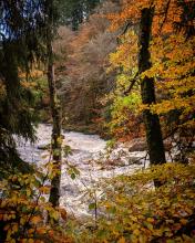
Understanding the response of trees to climate change is critical to managing Scottish biodiversity. Mounting pressures on biodiversity demand better design and monitoring of protected areas.
Quantitative genetic and population models are being used to understand how adaptation and plasticity mediate biodiversity responses to environmental change to better inform management.
3. Process-based life cycle modelling
Many crop pests and disease vectors that lead to crop losses have multiple distinct life stages (e.g. egg, larval, pupal, adult) which may occupy different ecological niches.
Process-based life cycle models are being developed to describe these multiple life stages and their interaction with the environment to better understand seasonal abundance patterns and potential efficacy of control measures under changing environmental conditions. Read the paper on applying this to potato cyst nematodes.
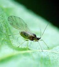
4. Hierarchical spatio-temporal modelling of aphid dynamics
Aphids → Viruses → Damage Potatoes → Food & £ Losses
Global warming affects plant virus levels spatially and temporally. Hierarchical spatio-temporal models are being built for aphid arrivals and abundances, to help build early warning tools for farmers and inform prophylactic actions.
BioSS contact

Ken Newman
This work is in collaboration with SEFARI, The James Hutton Institute, Science and Advice for Scottish Agriculture, Nature Metrics, The University of Glasgow, The Moredun Institute, UK Centre for Ecology and Hydrology, Centre of Expertise for Waters, Rothamsted Research, and Scotland's Rural College.
Scottish Government’s Rural and Environment Science and Analytical Services Division RESAS (BioSS-1-BET)